
Downwind route planning, built for kitesurfers.
A downwinder isn't a hike and it isn't a drive — a generic maps app has no idea what wind alignment, tidal landings, or a missing rescue plan actually mean for you. Here's what purpose-built route planning looks like, and why it matters.
Why a downwind route needs its own planner
A car route cares about roads and traffic. A downwind route cares about whether the wind stays aligned along the whole leg — not just the straight-line distance between two beaches. It cares about whether there's documented rescue or support coverage, or an honest admission that there isn't. It needs to flag hazards a map alone will never show you: a river mouth, an industrial port, a reef that reshapes with the tide. And it needs to know the tidal landing window at the far end, because a beach that's a soft landing at low tide can be closing out in shore break two hours later. None of that lives on a road map — it has to be built for the sport.
What a real downwind planning tool should show you.
Before you commit to a leg, a purpose-built planner answers these four questions — not after you're already on the water.
A leg-by-leg risk score
Not one number for the whole trip — a score per leg, so you know exactly which stretch of coast deserves your attention today.
Kite-size match for today's wind
The route plan and the wind reading talking to each other, so you launch on the right size for the leg you're actually about to ride.
A pre-flight safety checklist
Rescue contact, landing zone, safety leash, wind window — confirmed before GPS tracking starts, not remembered halfway down the coast.
Live GPS tracking with one-tap sharing
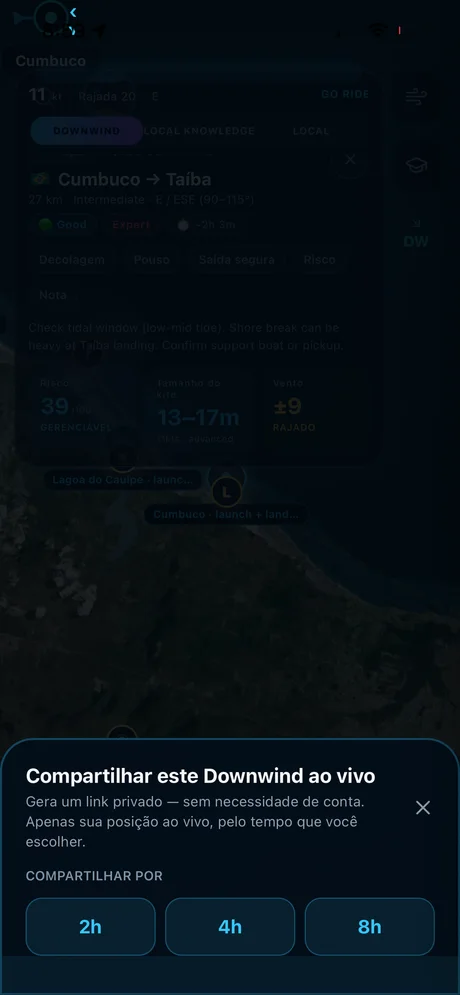
Distance, time, and speed tracked in real time, with a private link you can share in one tap — so the person you share it with can follow where you are.
Plan your downwind, start to finish.
AYON Wind's downwind planner carries route intelligence for every leg on the coast it covers: distance, difficulty, the ideal wind window, and a live risk score before you commit — built from the same local knowledge that guides riders who've done these routes hundreds of times.
Once you're moving, the plan doesn't stay static: live GPS tracking runs the whole way, and a private share link goes out in one tap — so whoever's picking you up, or just keeping an eye on you, always knows exactly where you are.
Take AYON Wind with you.
Current wind, gusts, and direction for every spot in this guide — plus route intelligence for the downwinders. Built by riders who call this coast home.