The coast,
understood once.
AYON Coastal Intelligence is the layer underneath the apps: downwind routes measured on real geometry, spots and hazards with named sources, and every claim carrying its own confidence. Wind reads it today. Wave's reader is built. Nothing is invented twice.
Live dataset 2026.09.23-03 · AYON Coastal Standard 3.0.0 — every file hashed in the manifest, every version immutable, no silent overwrite.
Evidence, not vibes.
Every entry states what kind of knowledge it is — a modeled estimate, a field observation, a documented record, a field-verified one — and what is simply not established yet.
Measured routes
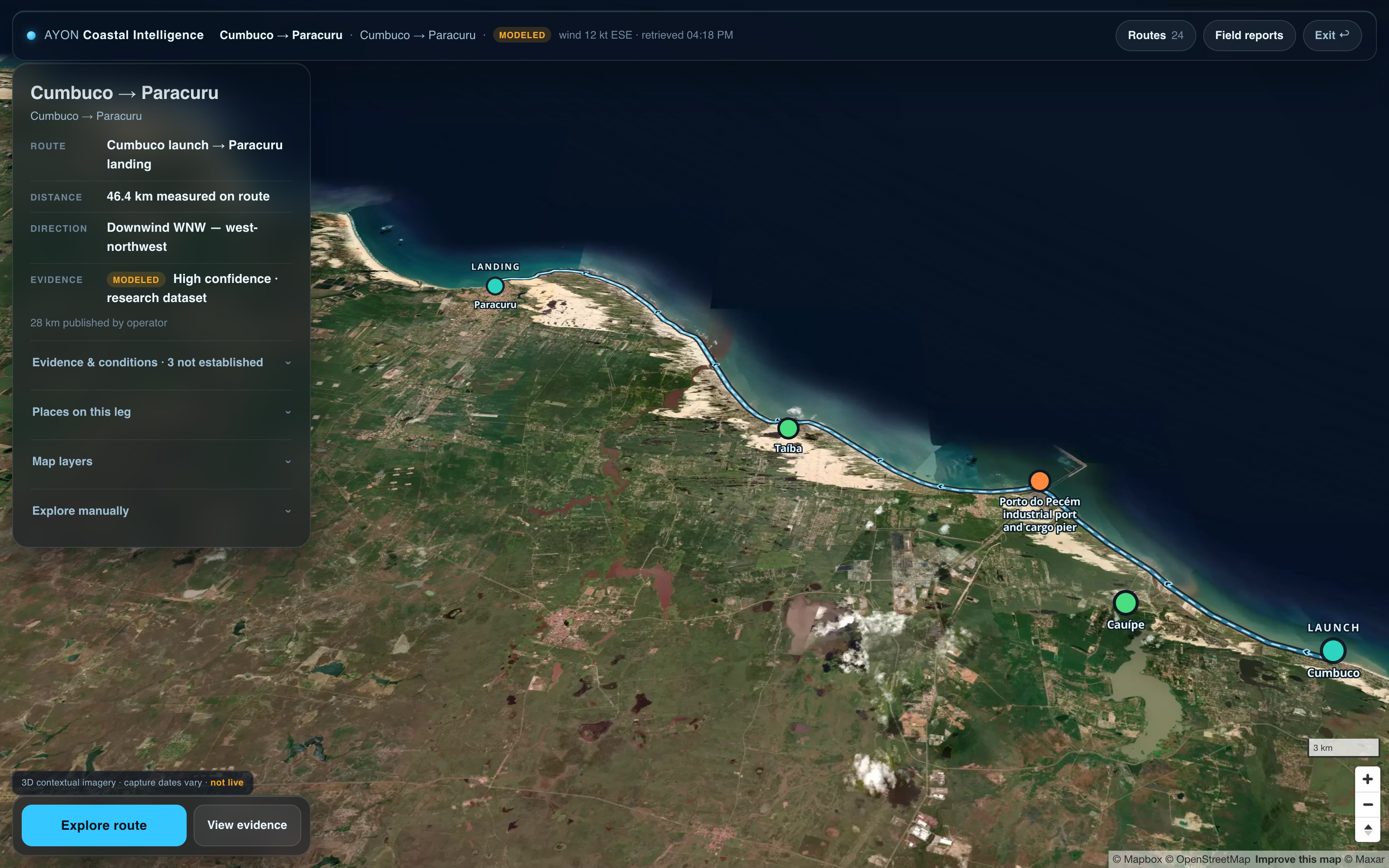
Downwind corridors with distance measured on the drawn geometry and direction derived from it — stated as measured, never assumed.
Spots with sources
Launches, landings and bailouts with named provenance and a last-verified date on each record.
Hazards on the record
Port zones, piers, regulatory notes — each with severity, confidence and the honest gaps left visible.
One layer, every app
AYON Wind reads this layer today — measured routes and the research library, live in the app. AYON Wave's reader is built and waits on a release flag. One understanding, carried everywhere.
An audited research catalog
Thirteen records published inside the dataset itself — each with its canonical source, provenance, licence and evidence class, in three languages. A record only appears after it passes the publication audit; eleven validator rules enforce that on every release.
Model checked against observation
Aviation METAR readings at Fortaleza compared hour by hour against NOAA GFS forecasts, partitioned by month, with the provider’s original bytes kept as received and hashed. The forecast and the reading are stored apart and labelled apart.
Confidence is earned per entry.
The dataset separates five kinds of claim — observed, modeled, documented, field-verified, not established — and never lets one dress as another. A model is never shown as an observation, and only a person going there earns field-verified. A route you fly in 3D shows the same evidence badges a researcher sees. That honesty is the product.
Locked before the outcome, scored after.
When a storm swell is on the way, the inputs are frozen and hashed before it arrives, and the call is scored against buoy observations afterwards — misses included. Hurricane Polo is Event 001, still in its capture phase; the Rachel watch was opened on 1 October 2026, before the swell existed at any Southern California buoy.
Every corridor, measured.
22 downwind corridors in the research dataset today — each with distance measured on its drawn geometry, evidence classes and hazards on record.
See the coast the apps see.
The live tool is open — routes, evidence and a 3D flight over every corridor.
Open the live toolWind. Waves. Coast. One intelligence system.